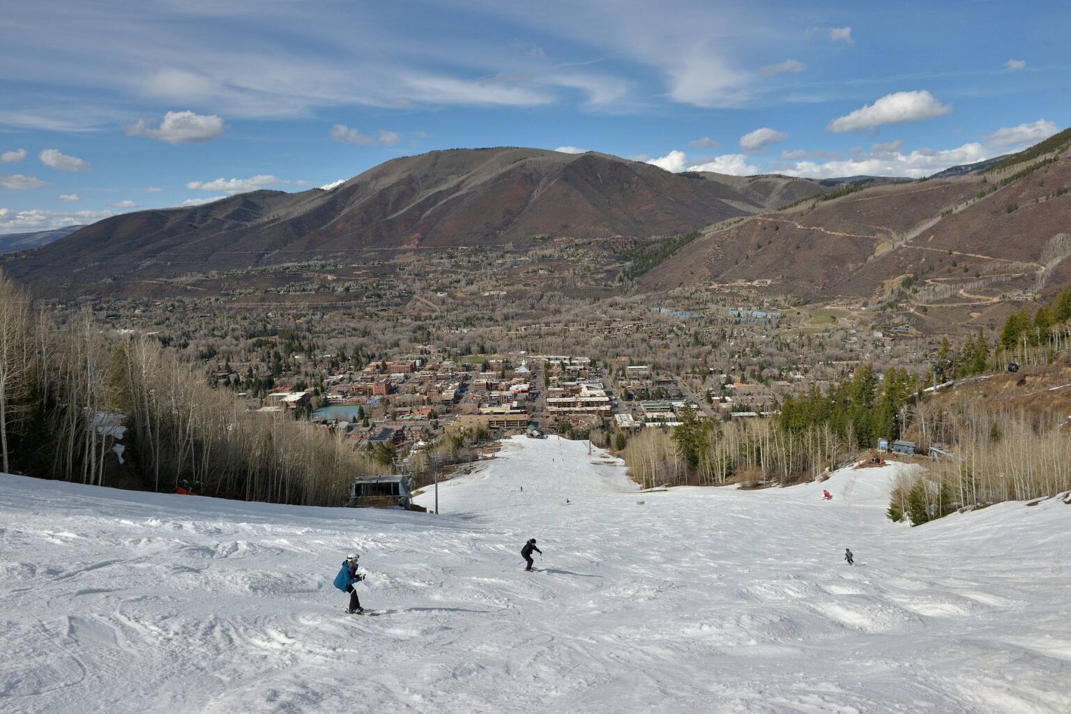
Where Cemetery Lane sits on Aspen’s west side
Cemetery Lane leaves Highway 82 on the west side of town, just past the Castle Creek bridge, and runs north toward the Roaring Fork River and the low green shoulder of Red Butte. It takes its name from the Red Butte Cemetery along the way. If you are weighing Cemetery Lane Aspen real estate, the first thing to understand is that the address is less about one street and more about where that street lets you go on foot.

The municipal Aspen Golf Club course lies between the lane and the highway, so the neighborhood has open ground on one side and the river corridor at the bottom. The housing stock is a mix of single family homes and duplexes from several different building eras, many of them on lots larger than what you find in the West End. It has always been the pocket between town and the country, and that is still the honest description.
The lane is a spine, not just a street
What buyers underrate is the path. The Cemetery Lane Trail is a paved corridor that ties together the ABC Trail, Bugsy Barnard Park, the Red Butte Cemetery, Tot Lot Park, the Red Butte Trail, Slaughterhouse Bridge, the Rio Grande Trail, Stein Park and McLain Flats Road. Aspen Trail Finder lists it at 1.1 paved miles, rated easy and dog friendly.
That is a short number with a large effect. When buyers ask why people on this side of town seem to leave the car in the garage, the answer is usually that everything they need is hanging off that one paved spine. It is also plowed and maintained through the winter for walking, running and fat biking, which is why foot traffic here does not stop in January.
Slaughterhouse Bridge and Rio Grande Trail access
At the bottom of the lane, Slaughterhouse Bridge, which plenty of people still call the Cemetery Lane Bridge, is one of the two everyday local entrances to the Rio Grande Trail. The other is the Mill Street bridge. If you want river trail access without driving to it, that bridge is the practical reason to buy on this side.
One detail for anyone planning to commute on a road bike: heading down valley, the Rio Grande surface changes, and the section from Cemetery Lane to Woody Creek is gravel. Road cyclists use McLain Flats Road to get around it. That is a five minute conversation that changes how some buyers rank this neighborhood, and no listing photo will tell you.
A short climb up Red Butte
About halfway up the lane, the Red Butte Trail turns off into single track and climbs to a wide overlook. From the top you take in Mount Sopris, Pyramid Peak, the view up Independence Pass, and across to Smuggler and Red Mountain, with the golf course and the bends of the river below. It is a short hike, not a big day, and that is the point: it is the kind of thing you can do before dinner.
What the golf course does for winter
In winter, the course between the lane and the highway becomes the busiest part of the free Aspen Snowmass Nordic Trail System. The Aspen Cross Country Center operates out of the pro shop at the public golf course, and Pitkin County treats the Aspen Golf Clubhouse as system headquarters for rentals, lessons and information. The system is free, runs more than 60 miles of groomed trail linking Aspen, Snowmass Village and Basalt, and is groomed daily by the City of Aspen Parks Department, with nearly five flat miles of loops on the golf course itself.
Here is the part locals know and a portal page will never mention. The Cemetery Lane path is plowed, not groomed, so you cannot ski continuously from the golf course loops onto the Rio Grande Trail. You walk or drive that connection. It is a small thing until you have planned your whole winter around it. Check the Nordic hotline and the trail system site for current conditions and opening timing rather than assuming a date.
The bus stop, and the intersection being rebuilt right now
Transit here is not theoretical. RFTA runs a fare-free Cemetery Lane route from Rubey Park Transit Center into the neighborhood, year round, which is a different level of service than most residential Aspen streets get. You can confirm the current schedule on the RFTA city of Aspen routes page.
The stop at Cemetery Lane and Snowbunny Lane / Silver King Drive is described in city staff reports as one of the most used in the area, serving neighborhood riders and Aspen School District pick up and drop off, and the intersection has documented accidents. The city is rebuilding it now, adding a rectangular rapid flash beacon, concrete pedestrian islands to shorten the crossing, a guardrail and a trench drain in the trail, at a total cost of about $621,000, with construction running from August toward the end of the 2026 season in October, according to The Aspen Times.
- Expect periods of one-way traffic control and short term bus stop changes, but no full road closure.
- RFTA has posted that the Silver King Drive stop is closed during construction, so if it looks abandoned when you tour, that is why.
- Conduit for a future WE-cycle bike share station is going in, but city staff have said the station itself is not in the current budget and will come only if the transportation department and WE-cycle reach an agreement.
- Pitkin County repaired and repaved its portion of the lane and did Slaughterhouse Bridge maintenance this spring, between April 6 and June 12, 2026.
I read that as a corridor being actively maintained, not a forgotten lane. Search the west side of Aspen on the map and you can see how tightly these pockets sit against the path.
Cemetery Lane vs the West End: two different rulebooks
This is the comparison I get asked about most, and the answer is not about charm. The West End carries City of Aspen historic preservation review on many parcels, where exterior and even some interior work on a designated property needs Historic Preservation staff review before it starts. Cemetery Lane is not a historic district, so that layer generally is not your constraint here.
The west side constraint is demolition. In its 2022 land use code overhaul, the city created a demolition allotment program that caps single family and duplex demolitions, meaning projects removing at least 40 percent of a structure, at six per year, awarded by lottery since late 2023, with two additional allotments for applicants who have owned an Aspen home for at least 35 years. As the Aspen Daily News has reported, council has since publicly discussed changing or eliminating the program, and allotment requests were still on council agendas in August 2026. Confirm the current code with the City of Aspen Community Development Department before you build a plan around it.
Cemetery Lane Aspen real estate in today’s market
I will not hand you a Cemetery Lane median, because there is not a credible one. The street is small, the housing stock varies too much, and any “typical price” you see quoted is an average of apples and snowplows. What I can give you is the citywide backdrop: AGMLS data pulled through Spark today shows 182 active residential listings in Aspen, a median list price of $9,199,000 and a median 95 days on market.
In a market that patient, the west side rewards buyers who know exactly which access they are buying. Start with current Aspen homes for sale, then read a few more Aspen neighborhood guides to see how this pocket compares with the mesa roads.
If you are selling here, document the access
On this street the sale is won on function, so my advice is to put in writing what a photo set cannot show: which path gate you use, how far the walk is to the plowed trail, which bus route stops nearby, whether the lot is duplex zoned, and whether any demolition or land use approval is attached to the parcel. None of that appears on an MLS sheet, and all of it changes a buyer’s math.
Frequently asked questions about Cemetery Lane Aspen real estate
Where is Cemetery Lane in Aspen?
It runs north from Highway 82 on the west side of Aspen, just past the Castle Creek bridge, toward the Roaring Fork River and Red Butte. The public golf course sits between the lane and the highway, and the Red Butte Cemetery, which gives the lane its name, is along the corridor.
Can you walk or bike from Cemetery Lane to downtown Aspen?
Yes. The paved Cemetery Lane path connects toward town and to the Rio Grande Trail at Slaughterhouse Bridge, and it is plowed in winter. There is also a fare-free RFTA route between Rubey Park and the neighborhood, year round, though one stop is temporarily closed during the intersection construction.
Is Cemetery Lane a good neighborhood in Aspen?
That depends on what you want from an Aspen address. If your priorities are a driveway, a garage, a larger lot than the West End typically offers, and direct trail, river and Nordic access, it does those things unusually well. If you want to walk to the Core in a few minutes, the West End or a Core condo will suit you better.
Can you tear down and rebuild a house in Aspen?
Sometimes, and not on demand. The city’s demolition allotment program limits projects that remove at least 40 percent of a structure and awards those allotments by lottery, with a small number available each year. Because the program has been under council review, verify the current rules with City of Aspen Community Development before you buy a teardown candidate.
Your next step on the west side
If Cemetery Lane is on your list, send me your must-haves and I will tell you what is realistic on this side of town, including which pockets use which path and bridge access. I keep a west Aspen access map and a parcel due diligence checklist I am glad to share before you write anything. Talk through a Cemetery Lane showing plan with me, or start with what is on the market in Aspen and we will walk the lane together.
One email from me every Saturday
The Aspen and Snowmass Village numbers for the week, what I am seeing on the ground, and one thing worth doing. No spam, and you can unsubscribe any time.