Most buyers meet Cemetery Lane at twenty five miles an hour, turning off Highway 82 on the west side of town with the Castle Creek bridge already behind them. That is the wrong speed for it. If you are looking at Cemetery Lane Aspen homes for sale, park at the bottom of the lane and walk the last stretch toward the Roaring Fork instead, because the case for this corridor gets made on foot, not through a windshield.
The lane runs north from the highway toward the river and Red Butte, past a mix of single family homes and duplexes built across several eras. It has held onto a between town and the country feel that the blocks on the other side of the bridge gave up a long time ago.
Starting at the bottom of the lane
The City of Aspen lists the Rio Grande Trail trailhead address as 585 Cemetery Lane. That address is the whole point. For a lot of homes out here the regional trail is the end of the block, not a destination you load the car for.
From there the trail follows the Roaring Fork in both directions, running continuously from Aspen all the way to Glenwood Springs, and Aspen’s trail network connects on to Snowmass Village and down valley toward Woody Creek and Basalt. The Aspen Times has described this as what turns the corridor into a walk and ride neighborhood rather than a drive only one. Stand at the bottom of the lane on a clear morning and you can hear why.
Up past the cemetery and the golf course edge
Walking north, you pass Red Butte Cemetery, a seventeen acre property owned by a nonprofit association since 1899 and historically landmarked in the 1990s, with mature trees, sculptures and gravestones. It reads less like a civic parcel and more like a grove that happens to hold Aspen’s history.
It also tells you something about the corridor. Neighbors here have turned out at city hearings over what gets built on that land, which is a fair preview of how people on this side of the bridge pay attention to their own street.
Tot Lot, Red Butte, and the climb before breakfast
Off Alta Vista Drive, Tot Lot Park sits at 801 Bonita Drive with a playground, a basketball court and an open field backing onto the Aspen Golf Club. Parking there is limited, and that limit is the information: this is a park people walk to, not drive to.
Then there is Red Butte Trail, which starts off Cemetery Lane from the same trailhead area. The City of Aspen Recreation lists it at 0.6 mile and moderate, and the Aspen Times describes it as an easy walk at first that turns into a rock scramble. Treat it as a before breakfast climb, not a casual stroll with coffee in hand.
What the golf course does for winter
The Aspen Golf Club is the neighborhood’s front yard for about half the year. The course closes to golf after October, with the 2026 season ending on closing day October 26, and the city then asks people to use the grounds for walking and leisure.
Here is the part people touring in October miss. The golf clubhouse is the headquarters of the Aspen Snowmass Nordic Trail System, more than 90 kilometers of free groomed trail according to the City of Aspen, groomed daily for classic and skate skiing, with the Aspen Cross Country Center run out of the pro shop. You look at a fairway in October. By January that same window looks at corduroy.
If you are picturing a casual walk on golf life, know the calendar. For 2026 the city reduced the total number of passes, eliminated the college, twilight and punch passes, verified primary residents by local zip code, and opened pass sales to verified residents on February 16 before the general public on March 9.
Cemetery Lane Aspen homes for sale: what the corridor actually gives you
Buyers usually arrive at this street after doing the math on the West End: more land, more parking, a real garage, and roughly the same ten minute reach into town. Inventory on the lane itself is thin enough that there is no honest month to month statistic for it, so I use citywide context instead.
Across Aspen right now there are 161 active residential listings with a median of 114 days on market, and the median sold price over the last 30 days came in at $7,637,500 across 21 closings, per AGMLS data pulled today. Those are city numbers, not Cemetery Lane numbers, and I will say so every time.
- A regional trailhead at the end of the block
- A free shuttle with a half hour headway into downtown
- A golf course that becomes a Nordic system in November
- A walk to neighborhood park with limited parking by design
- One bridge between you and everything east of Castle Creek
The Aspen Recreation Center, on the Maroon Creek side of the west end of town, reopened October 1, 2026 after a summer of pool deck, drainage and mechanical repairs, with all regular programming back. That matters because the ARC is part of the daily loop for anyone living out this way. If you want to see how the pieces line up, browse current Aspen homes for sale and then draw the map yourself on my home search.
The bus leaves Rubey Park at :00 and :30
This is the detail locals run their evenings on. The free City of Aspen Cemetery Lane shuttle leaves Rubey Park at :00 and :30 and comes back in from Red Butte Drive at :12 and :42, according to RFTA. A half hour headway between a downtown dinner and your own driveway changes how often you move the car at all.
The intersection at Snowbunny and Silver King
Where Cemetery Lane meets Snowbunny Lane and Silver King Drive is the corridor’s pinch point. The city’s staff report called that bus stop one of the most used in the area and noted documented accidents there.
The fix is on the ground now. Council approved the Cemetery Lane Multimodal Intersection Improvements Project, which adds a rectangular rapid flash beacon, concrete islands to shorten the pedestrian crossing, a guardrail and a trench drain, with construction scheduled to start August 10, 2026 and run through October under periods of one way traffic control and no full closure, per Aspen Community Voice. During construction the Silver King Drive shuttle stop was closed and riders were sent to a temporary stop at Sierra Vista Drive and Cemetery Lane. Conduit for a future WE-cycle bike share station is going in at the stop, but the city told council the station itself is not in the current budget, so the pipe is there and the bikes are not promised.
West Aspen vs the West End, and the bridge in between
The honest trade on this side is the Castle Creek Bridge. Aspen Daily News reported that traffic counts at the Castle Creek counter were up 3.5 percent in 2025 over 2024, and the McLain Flats route into Cemetery Lane has long been the known alternate during highway work.
There is also a bigger question under study. Conceptual refinements to the Entrance to Aspen reviewed by council include connecting Cemetery Lane to a new Highway 82 alignment so residents could head down valley directly, possibly with a new signal, though Aspen Daily News notes those designs are conceptual and subject to revision. Watch it. Do not price it into an offer.
Aspen market charts: the numbers behind this post

These charts are built from live AGMLS data the morning this was written. They are free to download and share; please keep the source line and credit The Aspen Realtor LLC.
Frequently asked questions about Cemetery Lane Aspen homes for sale
Where is Cemetery Lane in Aspen?
It runs north off Highway 82 on the west side of Aspen, past the Castle Creek bridge, toward the Roaring Fork River and Red Butte. The Aspen Golf Club sits along the corridor and the Rio Grande Trail trailhead is listed at 585 Cemetery Lane.
What is Cemetery Lane like to live on?
It depends on how you want to move. If a trailhead at the end of the block, a free half hour shuttle and a Nordic system out the back of the golf clubhouse describe your week, the corridor does a lot of work for you. If you want to be on foot to Hyman Avenue every night, the bridge is a real factor.
How far is Cemetery Lane from downtown Aspen?
Close enough that the free Cemetery Lane shuttle runs it on a half hour clock, leaving Rubey Park at :00 and :30 and returning from Red Butte Drive at :12 and :42. Many people out here walk or ride the Rio Grande Trail in good weather and take the bus the rest of the year.
What is there to do on Cemetery Lane in the winter?
The golf course stops being a golf course. The clubhouse is the headquarters of the Aspen Snowmass Nordic Trail System, groomed daily and free, and the city asks people to use the grounds for walking and leisure once the season ends. Red Butte Trail and the Rio Grande Trail are right there too.
Walk the lane at the hour you would come home
Tell me the time of day you would actually be pulling into that driveway, five o’clock in a January storm or seven on a July evening, and I will meet you on Cemetery Lane then. That is the one thing a listing portal cannot hand you, and it is also how I work with buyers.
If you want a short running list of what is active and under contract on the west side of the Castle Creek bridge, I will send it by email, because inventory here is small enough that a saved search beats a monthly report. Walk the lane with me, or start by poking around all of my current listings.
One email from me every Saturday
The Aspen and Snowmass Village numbers for the week, what I am seeing on the ground, and one thing worth doing. No spam, and you can unsubscribe any time.
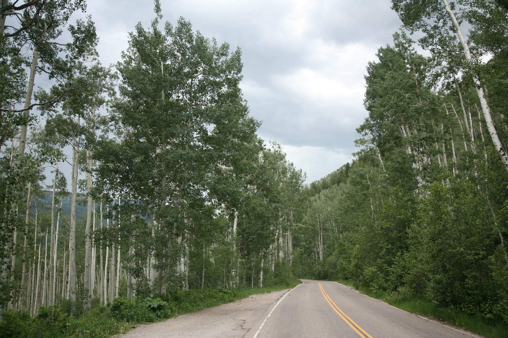
Photo: “Aspen trees 1” by Daniel Schwen, Wikimedia Commons, CC BY-SA 3.0.