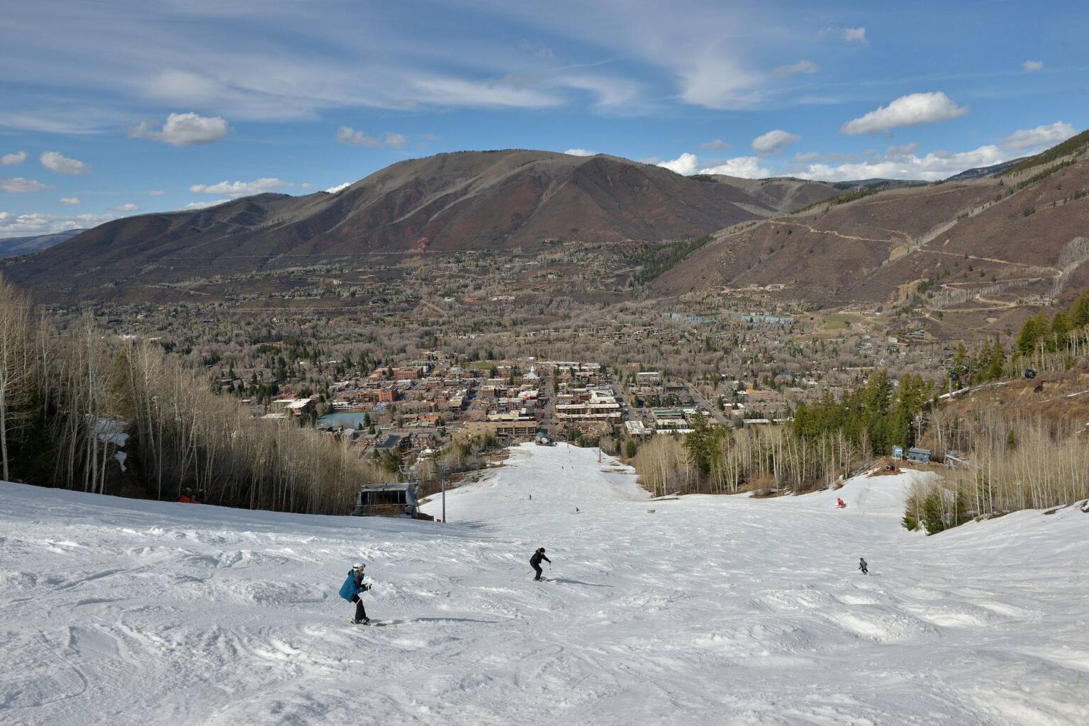
Cemetery Lane leaves Highway 82 on the west side of town, just past the Castle Creek bridge, and runs north toward the Roaring Fork River and Red Butte. It is named for the cemetery along it. Most buyers who ask me about Cemetery Lane Aspen homes for sale have only driven the street, and driving it tells you almost nothing about what owning here feels like.
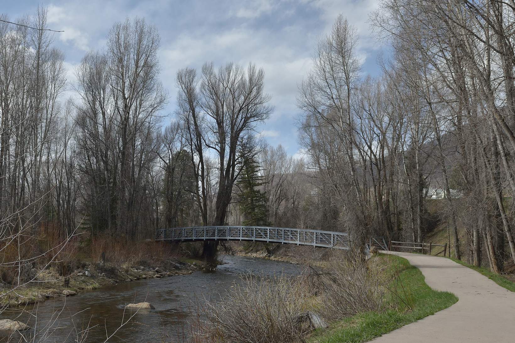
Walk it instead. There is a paved path along the lane, tree lined and separated from the road, running about 1.2 miles from Stein Park at the river down to Highway 82, according to TrailLink. The City of Aspen Parks and Open Space Department keeps its offices at 585 Cemetery Lane, which is a fair clue about where this neighborhood’s trail network starts.
The lane from Stein Park to Highway 82
Start at Henry Stein Park, below the Cemetery Lane bridge on the Slaughterhouse stretch of the Roaring Fork. There is parking and there are restrooms, and it is the practical river access point for this part of town. From there the path climbs gently along the lane under the trees, with the road beside you but not on top of you.
Here is the part I like telling people on the bench by the footbridge. Henry Stein bought a ranch in the Red Butte area in 1946, donated the park land, and put the footbridge over the river so he could ride between the ranch and his shop. He conveyed that bridge to the county for one dollar in 1973, as reported by Aspen Journalism. You are sitting on real local history, not a developer’s amenity.
Red Butte, the trailhead with no parking lot
Midway along the path there is a connection up to the Red Butte Trail, a short, steep, rocky stretch of dirt with big valley views that the Aspen Chamber hiking guide rates as difficult. There is no parking at the trailhead itself, so people walk up from Stein Park. That is one of the quiet advantages of living on this side of town: you are already parked.
Getting into town without touching the highway shoulder
This is the question I get most from buyers comparing west side Aspen to the West End or Smuggler. You do not have to ride the shoulder of Highway 82. A trail runs from Cemetery Lane through Bugsy Barnard Park and under the highway at the Castle Creek underpass to the Marolt Open Space, and the city has spent real money realigning it for sight lines and drainage.
- On foot or bike into town: the Bugsy Barnard Park connection and the Castle Creek underpass to Marolt.
- Along the river: the Rio Grande Trail runs east into downtown and west toward Woody Creek and Basalt, 42 miles in total to Glenwood Springs on the old rail grade, per Pitkin County Open Space and Trails. The first two miles out of town are paved, then the surface turns to compacted crusher fine for about two miles below Stein Park.
- By bus: the Cemetery Lane shuttle is fare free and runs year round from Rubey Park, outbound on the hour and the half hour, inbound from Red Butte Drive at 12 and 42 past. Hours shift by season, so check the current RFTA schedule before you build a routine around it.
The city is also rebuilding the busiest stop out here, at Cemetery Lane, Snowbunny Lane and Silver King Drive, with rapid flash beacons, concrete pedestrian islands and a guardrail after documented accidents at that intersection. Conduit for a future WE cycle station is going in with the work, though the station itself is not funded.
If you want to see what is currently available on this side of town, browse Aspen homes for sale and tell me which ones you want to walk.
What winter does out here
Winter changes the trail, it does not close it. The Rio Grande between the Aspen Post Office and Stein Park is groomed and snow packed rather than plowed, which opens it to skate skiers, classic skiers, fat bikers, walkers and runners instead of leaving a freeze and thaw ice sheet. It is also one of only a handful of Nordic routes in the Aspen Snowmass system where dogs are allowed on leash, and one of the few where biking and walking are permitted on the groomed surface.
Be clear about the difference, because it matters daily. The path along Cemetery Lane itself is plowed, not groomed. It is the walking and commuting link between the neighborhood and the groomed system, not part of the ski track. The Aspen Golf Club, about two miles west of downtown past the roundabout, serves as Nordic headquarters with rentals, lessons and the grooming report, and the city has a facilities master plan underway for that clubhouse campus through 2026.
Cemetery Lane Aspen homes for sale: what you are really buying
Houses here trade on location, access and condition, and condition is where offers get complicated. As of today there are 144 active residential listings in Aspen with a median list price of $8,974,500 and median days on market of 124, according to AGMLS data via Spark. Those are citywide figures across all of Aspen, not a Cemetery Lane average, so treat them as context rather than a price for this street.
What I do on this street is sort candidates into two piles before anyone writes anything: homes you can remodel inside the existing structure, and homes whose value depends on taking the structure down. Those are completely different purchases.
The demolition allotment that decides your plans
Aspen limits single family and duplex demolitions, defined as removing at least 40 percent of a structure, to six allotments per year citywide, awarded by lottery since the end of 2023, plus two more per year reserved for owners who have held and occupied an Aspen home for at least 35 years. That is the whole city, not this neighborhood. Council has debated changing or scrapping the program, so confirm the current rules with the City of Aspen building regulations page before you price a teardown into an offer.
The mitigation math changed with the same code overhaul. Sub grade areas, garages and vertical circulation now count toward the building area used to calculate affordable housing mitigation, and a demolished property no longer gets credit for its existing floor area. That is a budget line on a rebuild, not a footnote.
The Entrance to Aspen question is still open
No neighborhood watches this conversation more closely. Under the preferred alternative published by the City of Aspen, the existing Castle Creek Bridge stays in use as the local connection to the Cemetery Lane neighborhood and McLain Flats, and roughly 2.5 acres would be gained back from decommissioned Highway 82 between the roundabout and Cemetery Lane. A reevaluation of the realignment has been reported as potentially complete in November 2026. It is an open process, not a decided or funded outcome, and I will not sell it to you as either.
Aspen market charts: the numbers behind this post
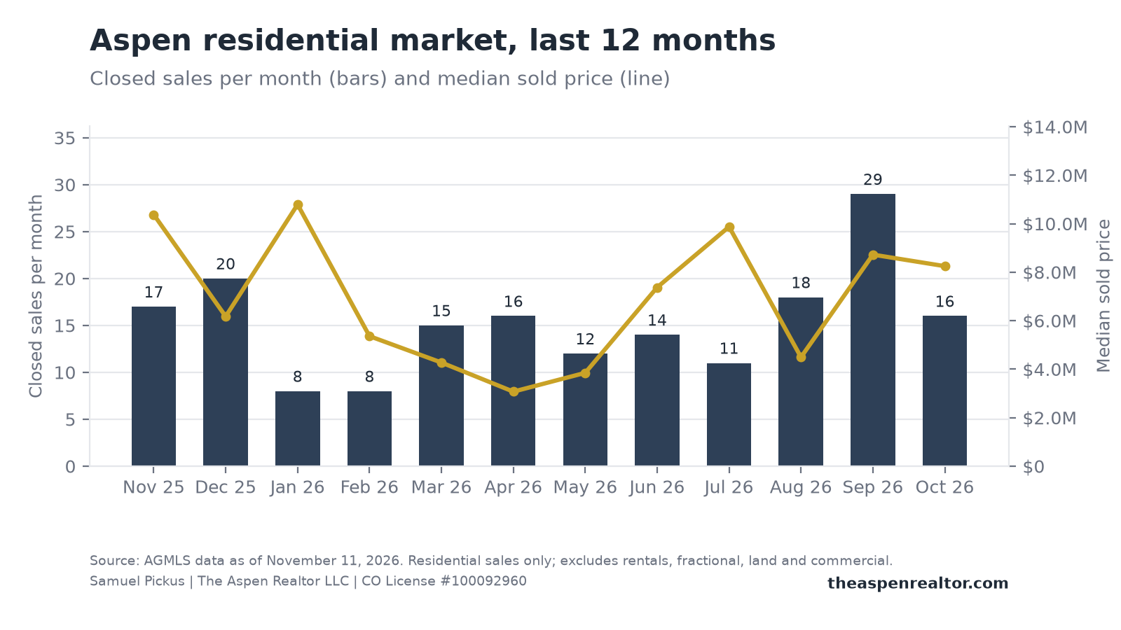
These charts are built from live AGMLS data the morning this was written. They are free to download and share; please keep the source line and credit The Aspen Realtor LLC.
Frequently asked questions about Cemetery Lane Aspen homes for sale
Where is Cemetery Lane in Aspen?
It runs north off Highway 82 on the west side of town, just past the Castle Creek bridge, heading toward the Roaring Fork River and Red Butte. The lane takes its name from the cemetery along it. Stein Park sits at the river end, below the Cemetery Lane bridge.
What is Cemetery Lane like to live on?
I can tell you what it offers rather than how it rates: a real Aspen address inside city limits, a dedicated paved path along the lane, a trailhead to Red Butte, river access at Stein Park, and a fare free shuttle into Rubey Park. Whether that suits you depends on how much you value trail and transit access over walking out your door into the downtown core.
How far is Cemetery Lane from downtown Aspen?
The path along the lane runs about 1.2 miles from Stein Park to Highway 82, per TrailLink, and from the bottom of the lane the Rio Grande Trail continues east into downtown along the river. The shuttle from Rubey Park runs on the hour and the half hour outbound, year round. I usually have buyers time the ride themselves so the number is theirs, not mine.
Can you tear down and rebuild a house in Aspen?
Sometimes, and not on demand. Removing at least 40 percent of a single family or duplex structure counts as a demolition, and the city issues six allotments per year citywide by lottery, plus two reserved for long term owner occupants. If your plan needs an allotment, that risk belongs in your offer terms.
Walk the lane with me before you write an offer
My favorite way to show this neighborhood is simple: meet at Stein Park, walk the path to the Red Butte connection, time the shuttle into town, then sit down and sort the candidate homes into realistic remodels and allotment dependent rebuilds. You can walk Cemetery Lane with me any week of the year, and I will come with the questions already written down.
In the meantime, search the Aspen map by street and neighborhood and save what catches your eye, or read more Aspen neighborhood guides while you narrow your list. Send me your must-haves and I will tell you what is realistic on this side of town.
One email from me every Saturday
The Aspen and Snowmass Village numbers for the week, what I am seeing on the ground, and one thing worth doing. No spam, and you can unsubscribe any time.
Photo: “Aspen bridge over Roaring Fork River” by Wolfgang Moroder, Wikimedia Commons, CC BY-SA 3.0.