Start behind the Aspen post office on an October morning, where the Rio Grande Trail picks up the Roaring Fork and the two of them travel together. The path crosses the river and Hunter Creek, then hugs the water down to Stein Park, where the pavement gives out under the Slaughterhouse bridge and turns to gravel. That short walk tells you more about Roaring Fork riverfront homes in Aspen than any set of listing photos will.
The other thing I point out is the sound. In June the river is full and loud and the banks are still green. By late September the cottonwoods along those banks turn gold and the water drops until you can read the cobbles on the bottom. I like to bring serious buyers out in the thin weeks of late fall, bare bank and low water, because a river house has to be worth owning at low water too.
The river through the middle of Aspen
The Roaring Fork is the spine of this valley. It starts above town near Independence Pass and runs about 70 miles to the Colorado River at Glenwood Springs, collecting Maroon Creek, Snowmass Creek, the Fryingpan and the Crystal along the way. Almost everything here is organized around it: the trail, the open space, a good deal of the zoning.
At the bottom of Cemetery Lane sits Henry Stein Park, only about 1.57 acres, owned by Aspen Valley Land Trust and managed by the City of Aspen. It is one of the few easy public put ins for rafting, kayaking and fishing on this part of the river, and the small lot fills up. If you are looking at the Cemetery Lane side of the water, walk it on a July Saturday, not a November Tuesday.
Downstream of town the water drops into the Roaring Fork Gorge, roughly 390 acres of open space, conservation easements, fishing easements and trail running from Stein Park to Wilton Jaffee Sr. Park near Woody Creek, taking in Slaughterhouse Falls, the historic Stein Bridge and the Gold Butte climbing area. Some of the water near Aspen carries recorded fishing easements, including the Moore Property and the Aspen Consolidated Sanitation District easements.
Roaring Fork riverfront homes in Aspen: what you actually own
Who owns the streambed in Colorado
Colorado is the outlier among western states on stream access. Research from the Common Sense Institute puts it plainly: on non navigable water the adjacent landowner owns the streambed, and the public does not get a high water mark exception. Own both banks and you own the bed between them.
That is the quiet luxury of a river parcel here, and it is also why “my neighbor’s guests are wading my water” is a real conversation on this river. Floating through private land in Colorado is a narrow and contested area of law, so I never tell a buyer that owning the bank keeps boats off the water. I tell them what the parcel owns and where the lines fall.
Why a public path is usually part of the picture
The Rio Grande Trail runs about 42 miles on the old Denver and Rio Grande Western grade from Aspen to Glenwood Springs, and Pitkin County Open Space and Trails calls it the county’s most heavily used trail. A lot of Aspen river parcels sit between the water and that corridor, and it is the everyday commuter and dog walk route for Aspen, Woody Creek, Basalt and Carbondale.
So private riverfront in this valley usually means a private bank with a public path nearby, not a sealed off canyon. Some buyers like that a great deal. Others need to know it before they get on a plane.
How close to the Roaring Fork River you can build
This is the rule that decides whether a riverfront remodel is a six month project or a two year one, and it changes at the city line.
- Inside the City of Aspen: any ground within 100 feet, measured horizontally from the high water line of the Roaring Fork or its tributary streams, triggers Stream Margin Review and heightened scrutiny to protect natural flow and the riparian buffer, per the City of Aspen Urban Runoff Management Plan.
- In unincorporated Pitkin County: the land use code requires a riparian and wetland buffer of at least 100 feet from the ordinary high water line for development after July 5, 2006.
- The reduction: that county buffer drops to no less than 50 feet only if the applicant can show no water quality degradation, no bank erosion and no loss of riparian habitat quality.
- The practical effect: two neighbors on the same bank can have very different buildable envelopes depending on when each house went up.
If the corridor is where you want to be, start with current Aspen homes for sale and send me the ones with water on the plat.
East Aspen river homes and the North Star float
East of town, along the highway toward Independence Pass and past the Aspen Club area, the river slows and spreads through North Star Nature Preserve, about 248 acres of protected bottomland where the float is flatwater and the wildlife is the point. Public access is limited to the east side of the river. The west side toward Aspen Mountain is closed, and getting out of a boat on that west bank is prohibited, per Pitkin County.
The float is not guaranteed every summer either. On June 27, 2026 the county had a mandatory river closure in effect inside the preserve boundary, from just above South Gate through Stillwater Bridge, triggered when flows dropped below 20 CFS. Beaver dams in the preserve are protected and may not be dismantled at any time. Bald eagles, osprey, great blue herons, elk, mule deer, beaver and the occasional bear all use this corridor, which is part of what you are buying.
What locals know about August water
Everything people here say about how quiet the river gets in late summer has a technical version. The Upper Roaring Fork River Management Plan identifies 32 cubic feet per second as the minimum streamflow for the stretch through central Aspen, and describes the reach between the Aspen Club and Castle Creek as particularly vulnerable to dewatering late in the season.
The 2026 season made the point. The City of Aspen enacted a Stage Three Water Shortage for the first time ever in May and chose to stay in it heading into winter, citing persistently low flows across the watershed after a record low snowpack. Mandatory restrictions include no outdoor irrigation between 8:00 AM and 6:00 PM and assigned irrigation days by address number, which matters if you are drawing up a riverside landscape.
The fishery is real regardless. The Roaring Fork carries Gold Medal designation on its lower reaches on Trout Unlimited’s Colorado Gold Medal waters list, and the Fryingpan near Basalt is the famous tailwater nearby.
What the Aspen market looks like right now
Aspen residential inventory sits at 149 active listings with a median list price of $9,000,000 and a median 122 days on market, and 14 homes closed in the last 30 days at a median sold price of $8,250,000, per AGMLS data as of today. River parcels are a thin slice of that, so timing and patience matter more than they do elsewhere in town.
For contrast, Basalt recorded 21 closed sales in the last 30 days at a median of $1,775,000 in the same AGMLS data. If the water matters more to you than the Aspen address, down valley river options in Basalt are worth an afternoon.
Aspen and Basalt market charts: the numbers behind this post
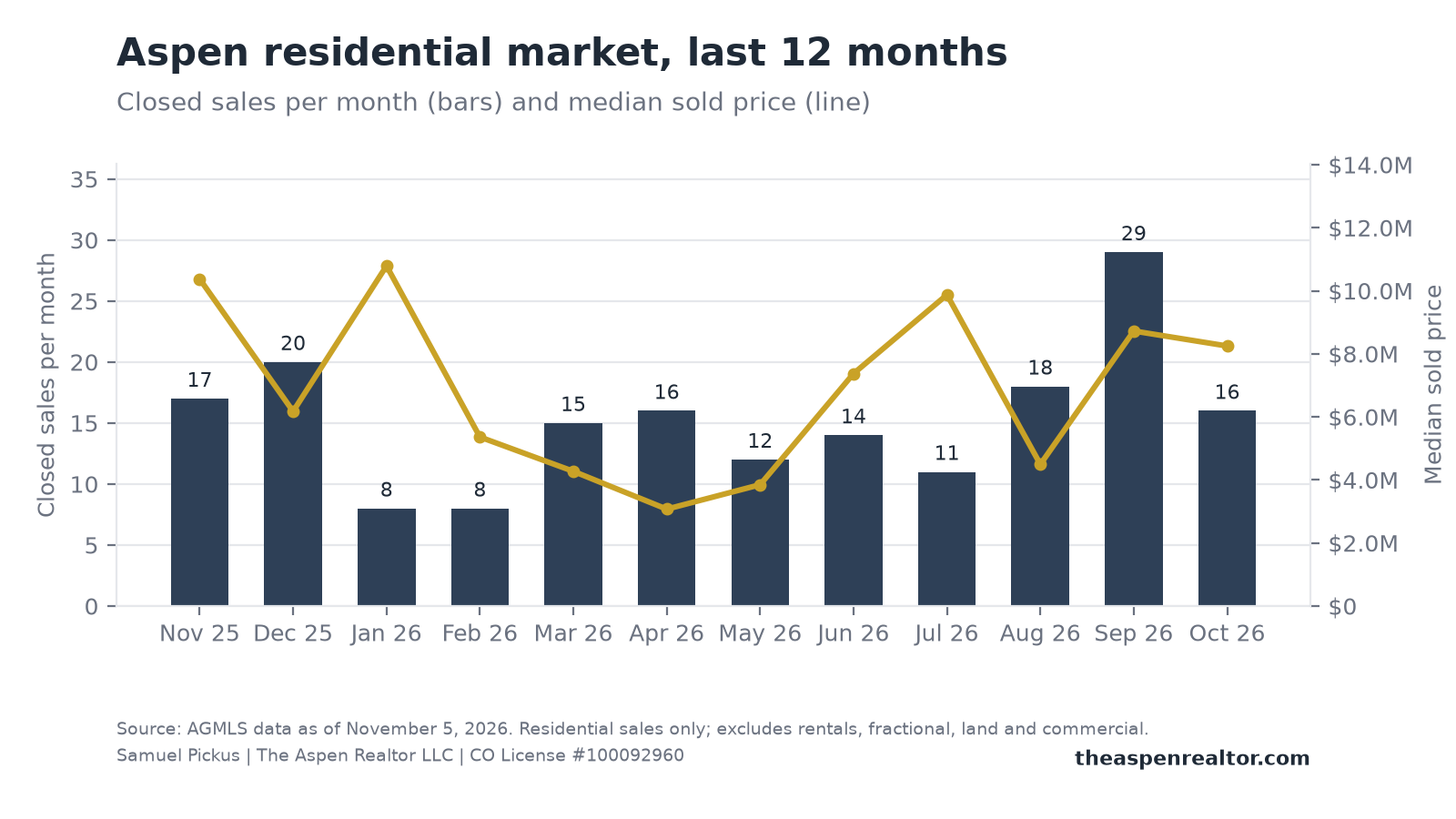


These charts are built from live AGMLS data the morning this was written. They are free to download and share; please keep the source line and credit The Aspen Realtor LLC.
Frequently asked questions about Roaring Fork riverfront homes in Aspen
Can you fish the river behind a private home in Colorado?
On non navigable water the adjacent landowner owns the streambed, and Colorado gives the public no high water mark exception, as the Common Sense Institute research describes. So the bed behind a private home is not open water for anyone who walks up. Some reaches near Aspen do carry recorded fishing easements, including the Moore Property and Aspen Consolidated Sanitation District easements in the Roaring Fork Gorge, which is why I read the title work before anyone writes an offer.
How close to the Roaring Fork River can you build in Aspen?
Inside the city, ground within 100 feet measured horizontally from the high water line of the river or its tributary streams triggers Stream Margin Review. In unincorporated Pitkin County the riparian and wetland buffer is at least 100 feet from the ordinary high water line for development after July 5, 2006, reducible to no less than 50 feet only on a specific showing. Where your parcel falls on that map shapes the remodel more than the architect does.
Are there riverfront homes for sale in Aspen, Colorado?
Yes, though they are a small share of the 149 active Aspen listings in the current AGMLS data. They turn up along the north edge of the West End, off Cemetery Lane, east of town toward the pass, and farther down the river around Woody Creek. Tell me what you want from the water and I will send you what is actually on or near it.
Does the Roaring Fork River run low in late summer?
It can, and in 2026 it did. The management plan sets 32 cubic feet per second as the minimum streamflow through central Aspen, and the county closed the North Star float when flows fell below 20 CFS in late June of this year. Buy the parcel for how it feels in August, not only in June.
Walk a river parcel with me before you write an offer
Before you make an offer on the water, I will meet you on the bank and pull the three things that decide the deal: which bank the parcel owns, where the 100 foot line falls for any remodel or addition, and how close the nearest public access and trail crossing sit. It takes an afternoon and it has saved buyers a year.
Send me your must-haves and I will tell you what is realistic, or walk a river parcel with me before you write an offer. You can also search Aspen listings on the map, river corridor included.
One email from me every Saturday
The Aspen and Snowmass Village numbers for the week, what I am seeing on the ground, and one thing worth doing. No spam, and you can unsubscribe any time.
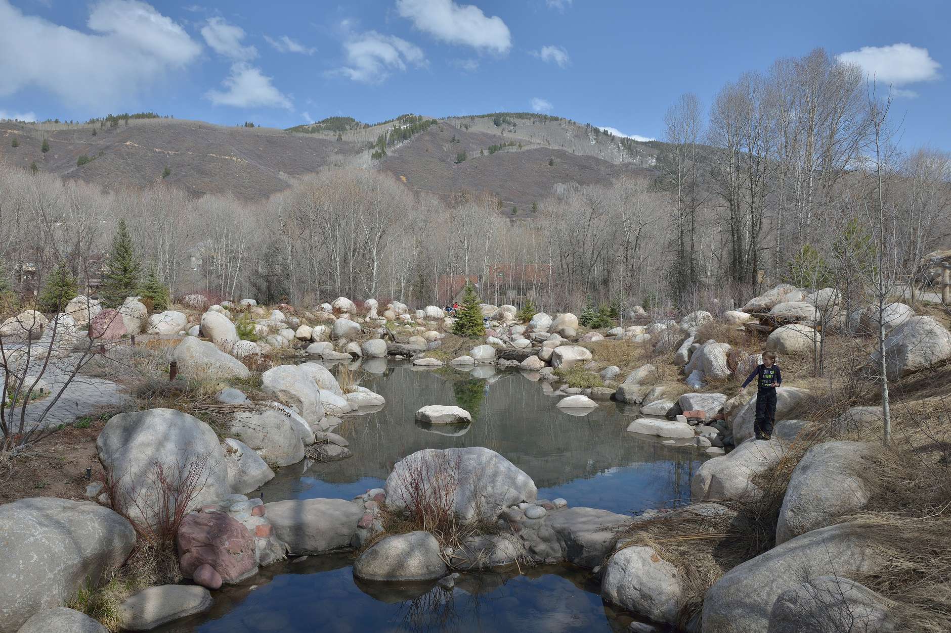
Photo: “Aspen John Denver Memorial Park” by Wolfgang Moroder, Wikimedia Commons, CC BY-SA 3.0.